

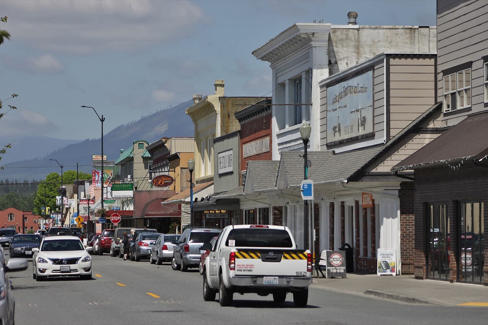
The two forks of the Stillaguamish River come together at Arlington, WA. The north Snohomish County city had 23,390 residents in OFM’s 2026 estimate, up from 19,868 in the 2020 Census. The city puts it about 10 miles north of Everett. A riverside park, the Centennial Trail through downtown, and an airfield from the 1930s give it shape.
Two towns, one name
The Stillaguamish people camped at the forks as they followed the fish runs and called the place Skabalko, according to the city. Settlers took longer to stay: Nels K. Tvete and Nils C. Johnson opened a store there in the spring of 1887, and a hotel followed a few months later.
Then came a rivalry. In 1890 two towns were platted a month apart. Arlington came first, in March, and Haller City followed on April 24, by HistoryLink’s date. Haller City held the riverbank; Arlington stood on higher ground half a mile away, and that is where the railroad put its depot in July 1890. By 1895 Tvete and Johnson had moved their store up to Fourth Street by ox team, the city writes. Voters approved incorporation 134 to 27 on May 5, 1903, and the result was certified on May 20; the new city took in both plats under one name. Division Street still marks the old line between them.
Where the river and the trails meet
Haller Park is 2.5 acres on the Stillaguamish, where the city says people come to watch eagles or fish from the bank. It has picnic shelters, a playground and a seasonal splash pad (as of October 2026 the city lists it as open daily from Memorial Day through Labor Day), plus access to the Eagle Trail at the stormwater wetland park just west.
The Centennial Trail runs paved through the city for walking and bicycling. Horses are not allowed inside city limits. Downtown, the trail passes murals and sculptures, and just south of Legion Park the Sound Garden sets out interactive musical instruments. Legion Park, on North Olympic Avenue, is the small downtown green where many of the city’s events happen.
The Whitehorse Regional Trail leaves the Centennial Trail in Arlington and runs more than 27 miles up the North Fork valley to Darrington, along the old BNSF railroad grade. Some sections close for repairs, so check Snohomish County Parks’ trail page for current status before heading out.
An airfield older than the war
Arlington’s airport began on February 13, 1934, when the Arlington Commercial Club leased 200 acres of forestland for $100 a year, according to the city’s airport history. With help from the town and the WPA, crews cleared a strip 4,000 feet long and 400 feet wide. The Forest Service soon used it to fly supplies to crews fighting fires in the Cascades.
The Navy leased the field in 1940. In 1942 the Army built two 5,000-foot asphalt runways there, and the Naval Auxiliary Air Station was commissioned on June 26, 1943. Before the war ended, twelve composite squadrons and six light air groups had trained there. The airfield still draws a crowd. The city’s 2026 Hometown Fly-In and Community Airport Day was held August 21–23, with flyovers and Young Eagles flights for young people.
Nearby, the Smokey Point area got its name in the 1950s from the Smokey Point Café, whose smoke plume was a local landmark, the city says, and it was annexed into Arlington on October 1, 1999.
How do people get around from Arlington?
As of October 2026, Community Transit buses from Smokey Point Transit Center connect to Lake Stevens, Stanwood, Darrington and Lynnwood City Center Station, the current northern end of Link light rail. Route 220 links Arlington with the transit center, and Route 230 runs east to Darrington. Drive times are traffic-dependent.
Living here
A store moved uphill by oxen, a depot that settled a rivalry, eagles over the river at Haller Park: Arlington grew up at the forks, and Division Street still remembers the rivalry. If you’re weighing a home near Olympic Avenue against one out toward Marysville or up the valley, or planning to sell in Arlington, Chase Hedin, Managing Broker, can help you think through the choice. Start a conversation · What’s my home worth?